File:Localisation-lorraine-france.png
From Wikimini Coordination Platform

Size of this preview: 249 × 239 pixels. Other resolution: 624 × 600 pixels.
Original file (624 × 600 pixels, file size: 101 KB, MIME type: image/png)
File history
Click on a date/time to view the file as it appeared at that time.
| Date/Time | Thumbnail | Dimensions | User | Comment | |
|---|---|---|---|---|---|
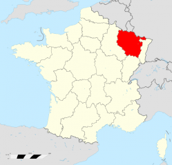
| current | 10:35, 20 February 2012 | | 624 × 600 (101 KB) | Jereemy | Localisation de la Lorraine (rouge) à l'échelle nationale. Source : [http://upload.wikimedia.org/wikipedia/commons/6/69/Lorraine_region_locator_map.svg Wikimedia] |
File usage
The following file is a duplicate of this file (more details):
- File:Localisation-lorraine-france.png from a shared repository
There are no pages that link to this file.