File:Localisation-Corse.png
From Wikimini Coordination Platform
Size of this preview: 240 × 239 pixels. Other resolution: 257 × 256 pixels.
Original file (257 × 256 pixels, file size: 19 KB, MIME type: image/png)
File history
Click on a date/time to view the file as it appeared at that time.
| Date/Time | Thumbnail | Dimensions | User | Comment | |
|---|---|---|---|---|---|
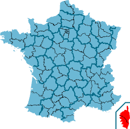
| current | 10:54, 22 February 2012 | | 257 × 256 (19 KB) | Jereemy | Localisation de la Corse (en rouge) à l'échelle nationale. Remarque : les lignes noires séparent les départements de France métropolitaine entre elles. Source : [http://fr.wikipedia.org/wiki/Fichier:Corse-Position.png] |
File usage
The following file is a duplicate of this file (more details):
- File:Localisation-Corse.png from a shared repository
There are no pages that link to this file.