File:L'île de la Réunion vue par le satellite Sentinel-2 (cropped).jpg
From Wikimini Coordination Platform
Size of this preview: 283 × 240 pixels. Other resolutions: 709 × 600 pixels | 3,281 × 2,777 pixels.
Original file (3,281 × 2,777 pixels, file size: 1.9 MB, MIME type: image/jpeg)
Summary
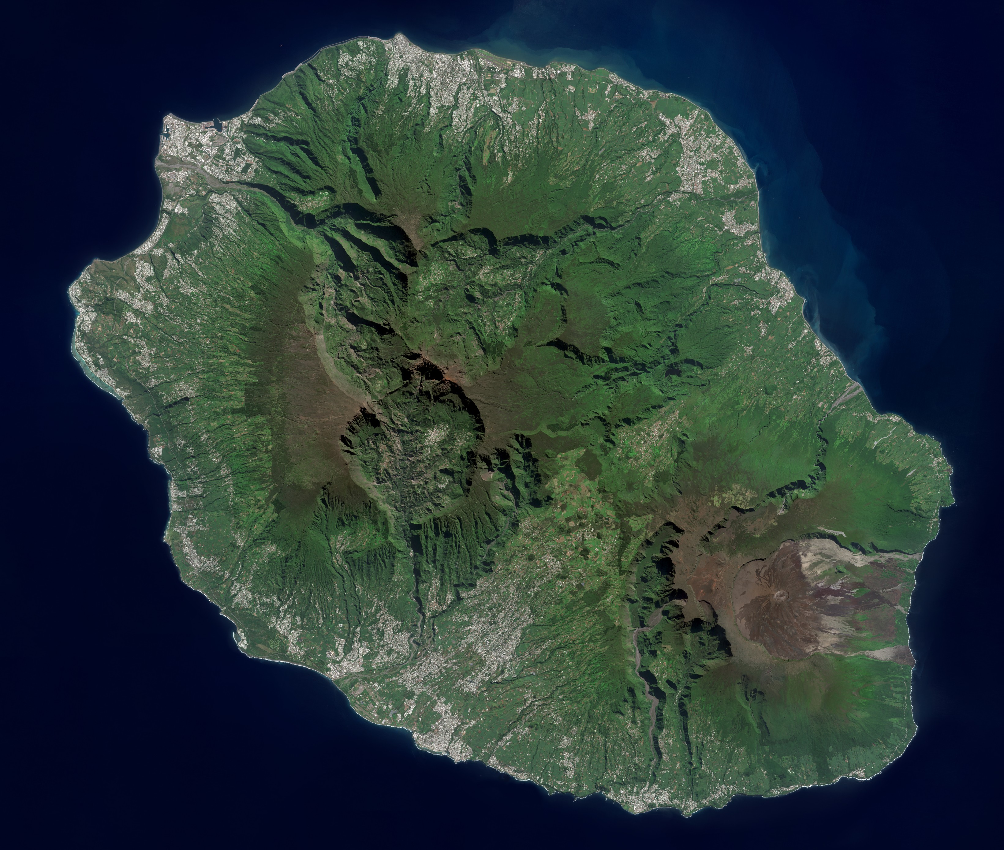
| Description |
Français : Vue satellite réelle de l'île de la Réunion prise par le satellite Sentinel-2.
|
| Source | Copernicus Sentinel-2 / Wikimedia Commons. |
| Author | ESA (European Space Agency). |
Licensing
| |
The person who uploaded this file (see below) certifies that he/she has verified the legal terms of use of this image/photo (coypright status) before adding it to Wikimini.
Specifically, use of this image/photo is permitted because it was published under the following free license:
|
File history
Click on a date/time to view the file as it appeared at that time.
| Date/Time | Thumbnail | Dimensions | User | Comment | |
|---|---|---|---|---|---|
| current | 22:27, 2 March 2026 | | 3,281 × 2,777 (1.9 MB) | Toto Rigolo | {{Information |Description = {{fr| Vue satellite réelle de l'île de la Réunion prise par le satellite Sentinel-2. }} |Source = Copernicus Sentinel-2 / Wikimedia Commons. |Author = ESA (European Space Agency). }} [[Category:History_and_geograph... |
File usage
The following file is a duplicate of this file (more details):
.jpg)
- File:L'île de la Réunion vue par le satellite Sentinel-2 (cropped).jpg from a shared repository
.jpg)
There are no pages that link to this file.
.jpg)
.jpg)
.jpg&action=edit&redlink=1)
.jpg)
.jpg&printable=yes)
.jpg&action=info)