File:Carte topographique de Zealandia.jpg
From Wikimini Coordination Platform
Size of this preview: 211 × 239 pixels. Other resolution: 640 × 725 pixels.
Original file (640 × 725 pixels, file size: 237 KB, MIME type: image/jpeg)
Summary
| ⧼wm-license-information-description⧽ |
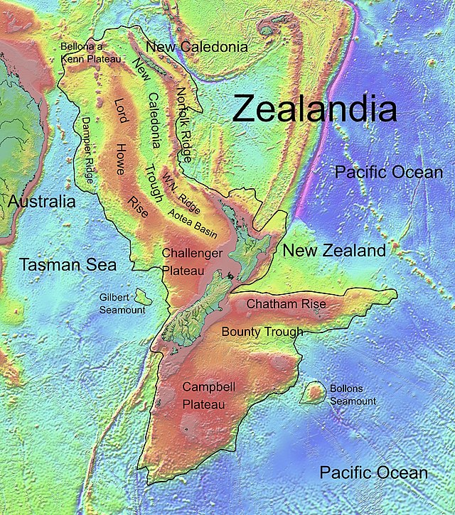
Français : Carte topographique de Zealandia.
|
| ⧼wm-license-information-source⧽ | Wikimedia Commons |
| ⧼wm-license-information-author⧽ | Ulrich Lange, Bochum, Germany |
Licensing
| |
The person who uploaded this file (see below) didn't provide all the required information on its copyright status and legal terms of use. Therefore, it is impossible to know whether the original creator of this image/photo allows his work to be re-used by others.
Unless it is demonstrated that the creator of this image/photo has released it under a free license, it shall be deleted soon. To the uploader: Most images you can find on the web or elsewhere are protected by copyright laws and permission is required to use them. Do not upload files if you are not sure whether you are authorized to add them to Wikimini. For more information, please read Wikimini:Règles d'utilisation des images (fr). |
File history
Click on a date/time to view the file as it appeared at that time.
| Date/Time | Thumbnail | Dimensions | User | Comment | |
|---|---|---|---|---|---|
| current | 16:52, 17 April 2023 | | 640 × 725 (237 KB) | KatchiCraft | {{Information |Description = {{fr| ''Carte topographique de Zealandia''. }} |Source = Wikimedia Commons |Author = Ulrich Lange, Bochum, Germany }} |
File usage
The following file is a duplicate of this file (more details):
- File:Carte topographique de Zealandia.jpg from a shared repository
There are no pages that link to this file.