File:Carte de l'Europe au XIIIe siècle-Saint-Empire romain germanique.jpg
From Wikimini Coordination Platform
Size of this preview: 320 × 240 pixels. Other resolution: 800 × 600 pixels.
Original file (800 × 600 pixels, file size: 441 KB, MIME type: image/jpeg)
File history
Click on a date/time to view the file as it appeared at that time.
| Date/Time | Thumbnail | Dimensions | User | Comment | |
|---|---|---|---|---|---|
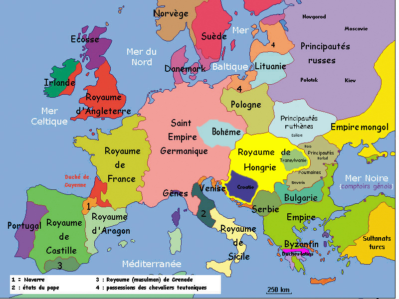
| current | 02:11, 11 November 2010 | | 800 × 600 (441 KB) | Lorangeo | Carte de l'Europe au XIIIe siècle. Le Saint-Empire romain germanique n'est pas un état unitaire mais un ensemble complexe de royaumes, duchés, principautés, etc. Source : http://commons.wikimedia.org/wiki/File:Europe13eSiecle.jpg?uselang= |
File usage
The following file is a duplicate of this file (more details):
- File:Carte de l'Europe au XIIIe siècle-Saint-Empire romain germanique.jpg from a shared repository
There are no pages that link to this file.