File:Carte de Saint-Vincent-et-les Grenadines.png
From Wikimini Coordination Platform
Size of this preview: 223 × 239 pixels. Other resolution: 328 × 352 pixels.
Original file (328 × 352 pixels, file size: 10 KB, MIME type: image/png)
File history
Click on a date/time to view the file as it appeared at that time.
| Date/Time | Thumbnail | Dimensions | User | Comment | |
|---|---|---|---|---|---|
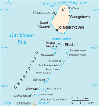
| current | 18:43, 10 June 2010 | | 328 × 352 (10 KB) | Lorangeo | Carte de Saint-Vincent-et-les Grenadines. Source : http://commons.wikimedia.org/wiki/File:Saint_Vincent_and_the_Grenadines-CIA_WFB_Map.png |
File usage
The following file is a duplicate of this file (more details):
- File:Carte de Saint-Vincent-et-les Grenadines.png from a shared repository
There are no pages that link to this file.