File:Carte-France-Outre-Mer-DOM-TOM.png
From Wikimini Coordination Platform
Size of this preview: 320 × 162 pixels. Other resolutions: 800 × 406 pixels | 1,880 × 954 pixels.
Original file (1,880 × 954 pixels, file size: 313 KB, MIME type: image/png)
File history
Click on a date/time to view the file as it appeared at that time.
| Date/Time | Thumbnail | Dimensions | User | Comment | |
|---|---|---|---|---|---|
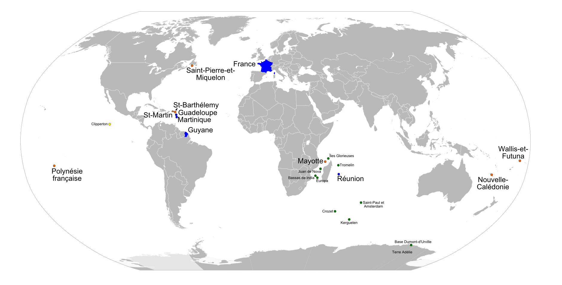
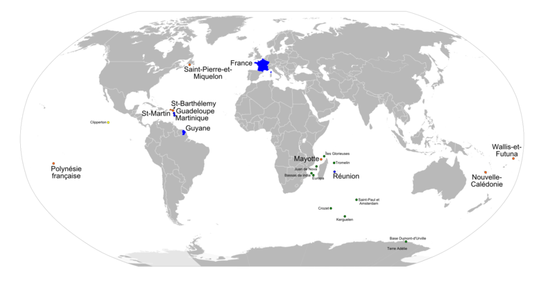
| current | 11:50, 22 February 2012 | | 1,880 × 954 (313 KB) | Jereemy | La France d'outre-mer à l'échelle mondiale. Légende : * Bleu : La France métropolitaine et les départements-régions d'outre-mer (DOM-ROM) * Orange : Les collectivités d'outre-mer et la Nouvelle-Calédonie * Vert : Les Terres australe |
File usage
The following file is a duplicate of this file (more details):
- File:Carte-France-Outre-Mer-DOM-TOM.png from a shared repository
There are no pages that link to this file.