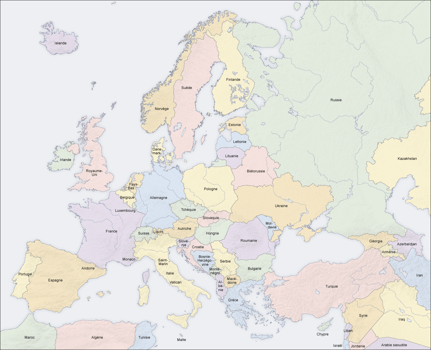
File:Carte-Europe-pays.png
From Wikimini Coordination Platform
Size of this preview: 295 × 240 pixels. Other resolutions: 738 × 600 pixels | 1,475 × 1,200 pixels.
Original file (1,475 × 1,200 pixels, file size: 612 KB, MIME type: image/png)
File history
Click on a date/time to view the file as it appeared at that time.
| Date/Time | Thumbnail | Dimensions | User | Comment | |
|---|---|---|---|---|---|
| current | 10:37, 23 October 2008 | | 1,475 × 1,200 (612 KB) | Lorangeo | Carte actuelle des pays d'Europe. Cette image provient de [http://commons.wikimedia.org/wiki/Image:Europe_countries_map_fr.png?uselang=fr Wikimedia Commons]. |
File usage
The following file is a duplicate of this file (more details):
- File:Carte-Europe-pays.png from a shared repository
There are no pages that link to this file.