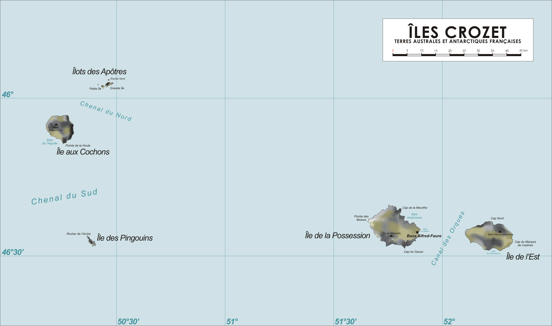
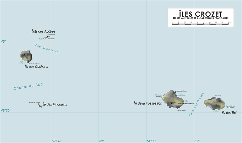
File:Carte-Îles-Crozet.png
From Wikimini Coordination Platform
Size of this preview: 320 × 189 pixels. Other resolutions: 800 × 473 pixels | 2,280 × 1,348 pixels.
Original file (2,280 × 1,348 pixels, file size: 246 KB, MIME type: image/png)
File history
Click on a date/time to view the file as it appeared at that time.
| Date/Time | Thumbnail | Dimensions | User | Comment | |
|---|---|---|---|---|---|
| current | 14:04, 24 February 2012 | | 2,280 × 1,348 (246 KB) | Jereemy | Carte des îles Crozet. Source : [http://fr.wikipedia.org/wiki/Fichier:Crozet_Map.png] |
File usage
The following file is a duplicate of this file (more details):
- File:Carte-Îles-Crozet.png from a shared repository
There are no pages that link to this file.